One thing I have learned to love about outdoor adventures is the discovery. Of course, others have been there before me and have seen what I have, but it’s about the excitement for me to discover it for myself. Because of this, I have changed my views on giving too much information or turn-by-turn directions on finding locations like most do. I want you to have the same excitement when finding these locations for the first time, for yourself.
Lately, I have been searching for waterfalls without the use of GPS to find them. Of course, I bring a TOPO map and do some research beforehand. I try to discover them without a pin saying where to go. It adds to the sense of adventure.
Thunder Canyon Falls was a great discovery. I had a good idea where the falls may have been located but it was my first time in this area. I went on this adventure on a cold, foggy day with my friend Bruce who had also been wanting to chase waterfalls.
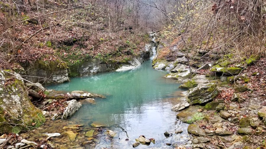
We started at Erbie, AR on the Cecil Cove Loop. This is a beautiful trail with many creek crossings, so be prepared to get wet. We started by heading down the hill to a spring-fed creek that ran into Cecil Creek. Really the spring is very interesting and the water was so clear. It had a teal color to it; just an amazing spot to stop and relax for a few minutes. Following the trail, we made a few dry creek crossings and continued up following wonderful views of the creek. I am convinced that parts of this valley must have been farmland. Among the trees, we found large piles of stone as if a farmer had once spent a lot of hard work clearing. These were spread out along a straight line as the trail passed many of these piles.
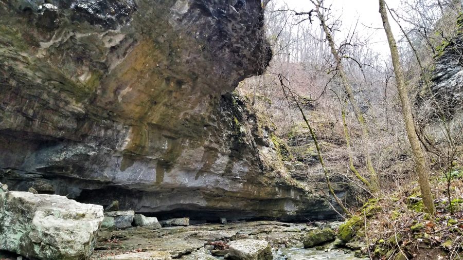
When we came to our first river crossing I studied the map and decided that we should probably just follow the creek off the trail and end up wherever we wanted. This proved to be much more work and we still ended up having to cross the creek, so it was decided best to follow the trail. After learning my side path was not worth the time to cross the creek, we were back on the trail. Amazingly, we came to a dry crossing where the water was flowing underground. This seemed to work perfectly because of the location near Thunder Canyon.
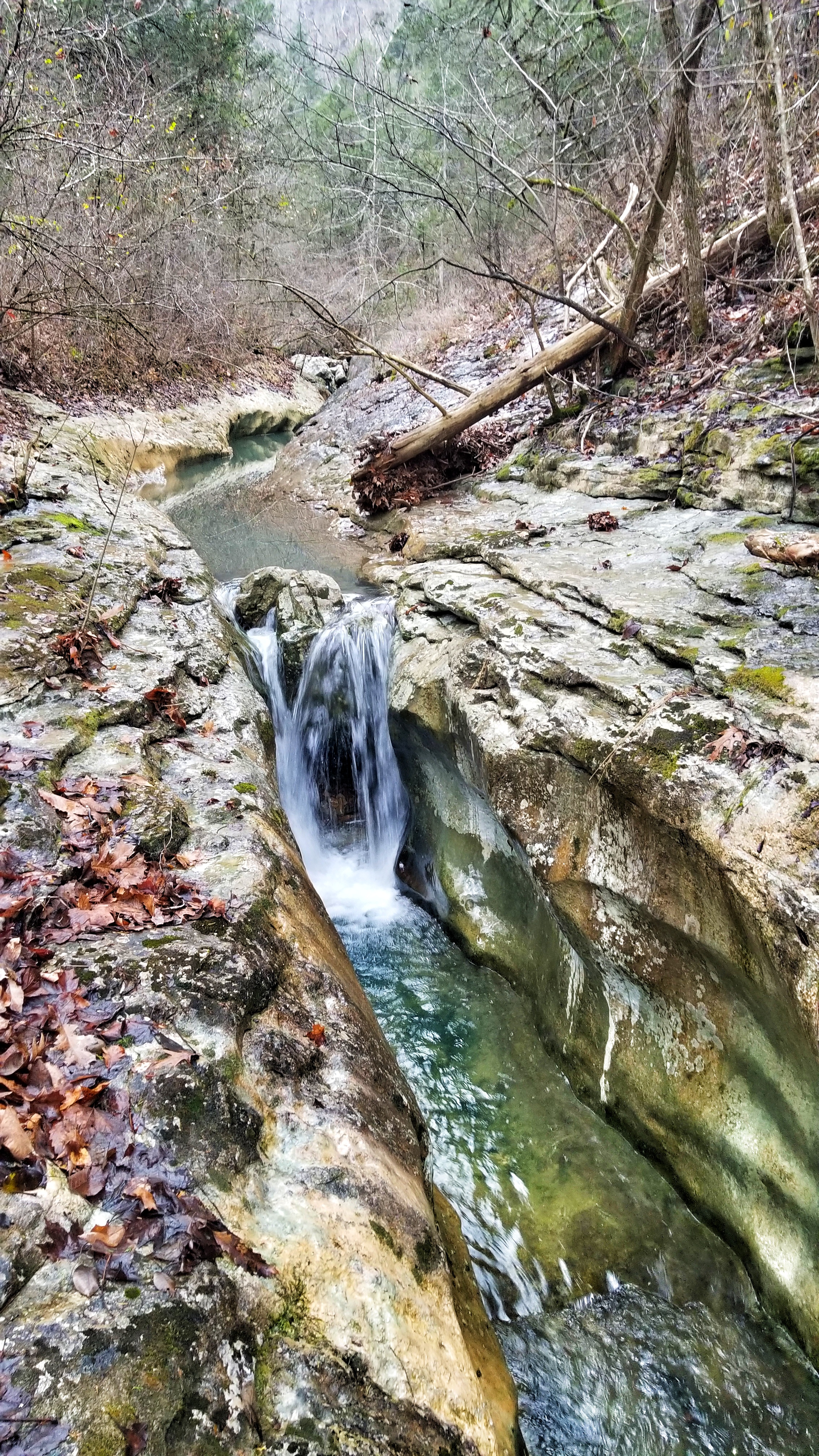
With no trail markers and a very primitive trail, we followed a small creek up the canyon. This was the hardest part of the trip. If you find yourself on this trail, you will need to cross the creek many times with very slick rocks and muddy paths. Take your time during this part to avoid broken bones. Despite the difficulties, there are many photo-worthy spots along this section. There are several small waterfalls and pools of water. Take your time and enjoy every step.
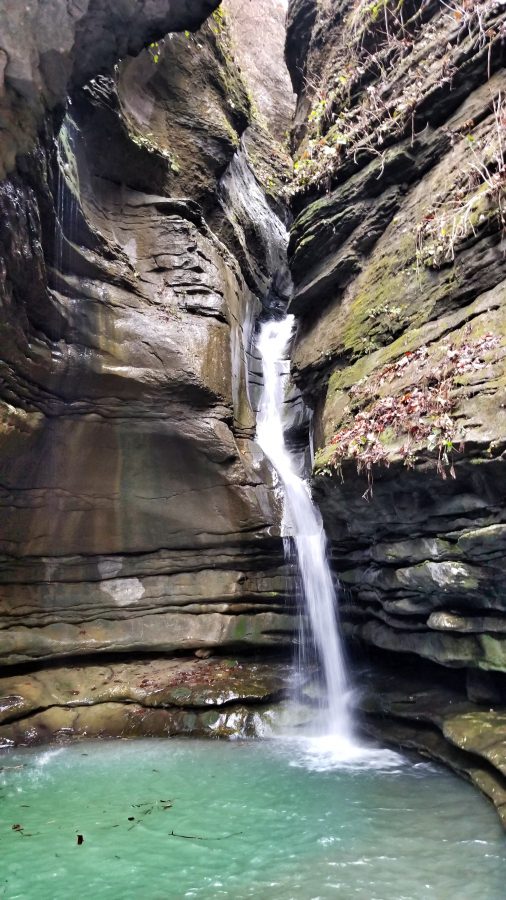
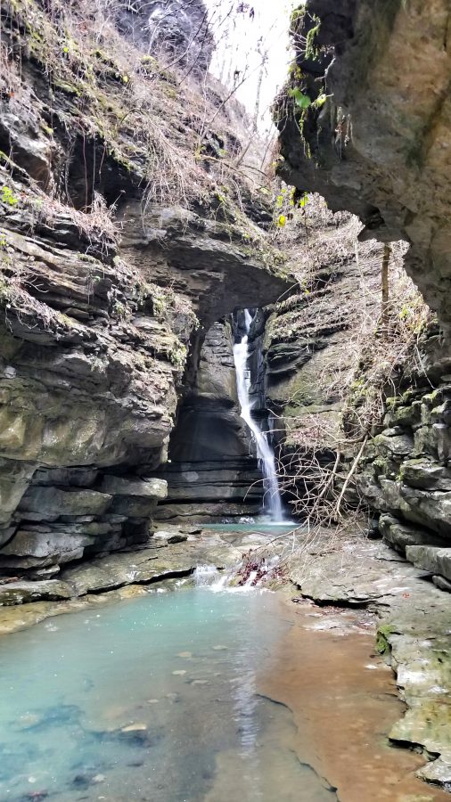
You’ll know when you are near when you hear the sound of roaring water. It really does sound like thunder when you approach the falls. This area is nothing but slick rock. Both Bruce and I took some bad falls. Luckily we didn’t break anything but our pride. Here we found what we had been waiting for; a gorgeous, and what will appear as an untouched, lost canyon. The waterfall flows down many cascading drops, which appears to possibly have more to see above. With the slick rocks and the impossible walls, I just can’t see how a person could see these unless they come from the top with ropes.
The only thing I regret is not taking the time to check out the pool of water next to the base of the falls. I wasn’t able to see the bottom so now I wonder just how deep it was. I guess it’s a good excuse for me to return soon. Overall, this adventure was amazing! Nothing to regret, even my fall holds lessons and memories for me.
 Just remember: discovering these places for yourself is half of the adventure. Learn how to read a TOPO map and get out there and explore.