Indian Creek is found in the Buffalo National River watershed near Jasper, AR. It consists of many small and large waterfalls and is the home of the rock formation known as the Eye of the Needle. With a very primitive trail and an altitude change of 660 ft., this isn’t your family-friendly hike. With many accidents happening every year this creek could easily take a person’s life.
I won’t share the exact starting point as many locals oppose the sharing of spots out of concern of people trashing them. Be sure to follow the park rules on leaving no trace before you start this hike. You can find Indian Creek on any Buffalo River map near Kyles Landing.
You’ll start off on a well-maintained trail for 100 yards until it hits Indian Creek and then it turns into many small paths that wind back and forth across the creek.
When I did this hike the creek was dry at this section, so crossing the creek was easy. With a little rain, I can see this being more work.
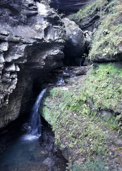
Heading up the creek we came to our first waterfall and really our first sign of water that day. Here we filtered some drinking water and had to climb the slick rocks. Once over this short waterfall, we found a muddy path around the next part of the creek. This proved to take a little more time as we didn’t want to slip and fall on the rocks. Once past this, you’ll find a more defined path which you will follow, taking you back and forth across the creek which now has running water. We found a few spots with small ledges or
large boulders we had to cross. Taking your time is very important here as the rocks can be very slick and someone could easily break an arm or leg.
Following the path, we eventually came to somewhat of a fork. One tree had a small orange rope tied to it as a marker. This is the path we took, though it looked more adventurous. It was a very muddy climb to the top of a bluff with a great view. The path took us to the very edge of this bluff that had to be over 200 ft. high. At one point the path was no more than an inch from the edge. I’m not afraid of heights but I was very nervous about the damp leaves and mud that close to the edge. Once past this, the path opened up but still dangerous in many areas.
Once back down, we followed the creek to a beautiful cascading waterfall. To the right of the falls were many climbing ropes going up over a 10 ft. ledge and a 150 ft. muddy hill. With the ground damp from the falls the rope helped a lot to keep us from sliding back down towards the creek. Taking your time in this section is very important along with having a good grip on the ropes.
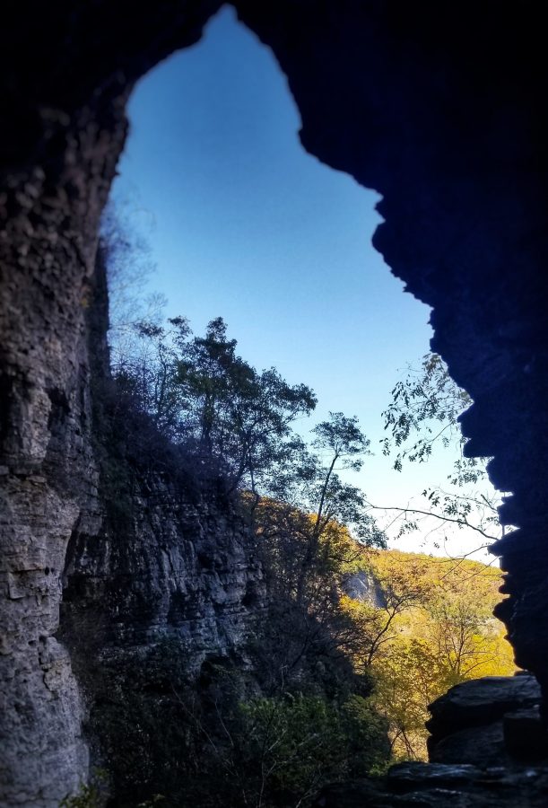
At the top, you will want to rest as the climb will wear most people out. Take in the sights of Arkansas Cave across the creek and the bluffs farther down the creek.
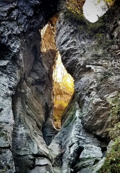
After resting up, climb to the left side of the bluff to find a small tunnel. Take this to the other valley. Again the path opens up and takes you back down the creek. Keep following the creek climbing over large boulders for about 1/4 of a mile. Here you’ll find Eye of the Needle.
There was no water flowing through the eye on the day we went. However, it was still a great view. Photos can’t capture the true size of this rock formation. It’s massive! Take in the view and your surroundings as you’ll find many smaller rock formations and boulders larger than most cars and trucks.
To find your way back just follow the creek. However, be careful as many spots might be harder going down then up.
I only had one disappointment when I hiked this creek. Once at the eye I noticed someone had carved their name into the stone. Also, someone had used a large boulder as a bathroom for everyone to see. This is where I struggle with sharing my posts and trips. I know everyone should be able to enjoy these amazing places, but at the same time, we need to protect them. Please don’t write your name on this beautiful landmark. Also, follow the park rules when using the restroom in the wilderness. No one wants to see this.